
KMZ for Google Earth
A KMZ file shows your flights or detections on a 3D map. You can replay them, see where the pilot stood and click a marker for details. Open the file in Google Earth Pro. Most GIS tools can import it too.
Heights are drawn above sea level, so the track sits at the right height over the terrain in Google Earth.
What Is in the File
Each flight or detection has its own folder, named after its serial number. Inside, every layer is a folder with its own checkbox in the Places panel, so you can turn layers on and off.
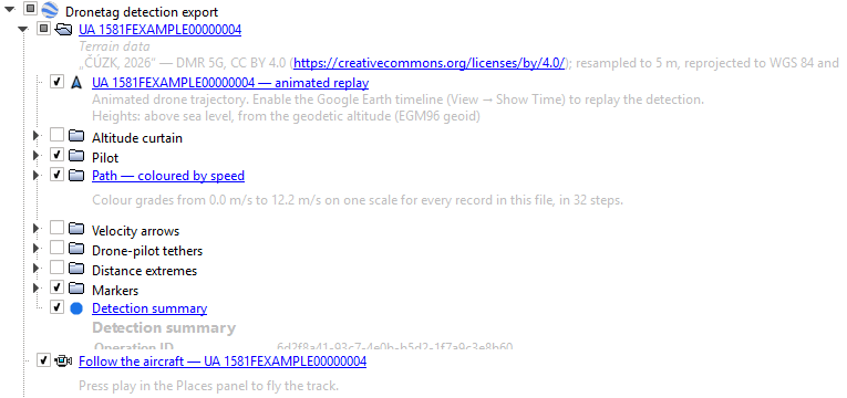
Shown When You Open the File
| Layer | Looks like | What it shows |
|---|---|---|
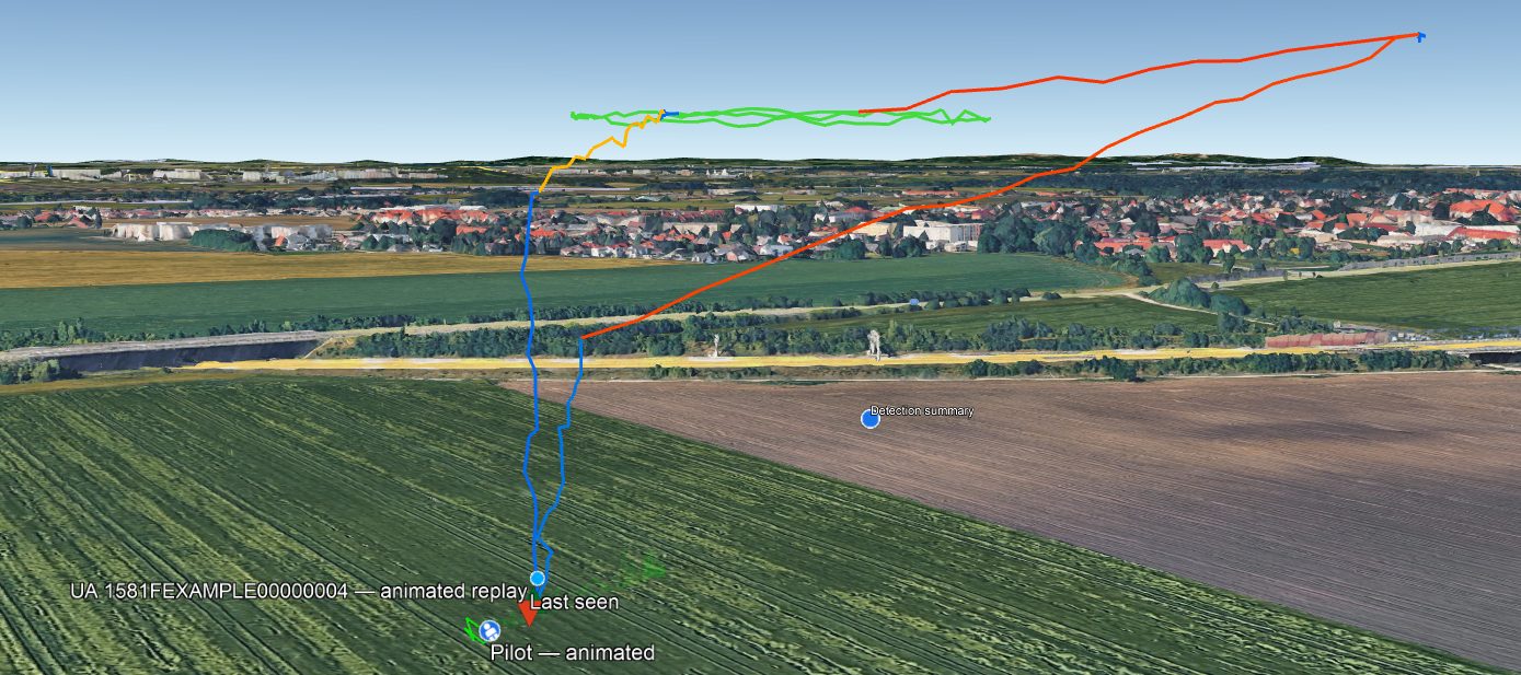
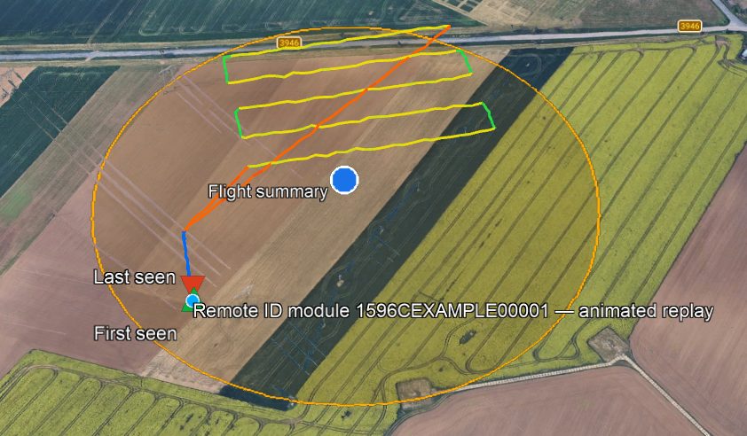
| Aircraft | Light-blue dot with a white rim | The drone. It moves when you replay the flight. |
| Path | Line coloured by speed | The whole track. Blue is slow, red is fast. The legend in the corner gives the values. |
| Pilot | White figure on a blue disc | Where the pilot was. It moves with the replay. Detections only. |
| Take-off point | Orange take-off symbol on a white disc | Shown when the drone sent its take-off location instead of the pilot's position. Detections only. |
| First seen | Green triangle pointing up | The first recorded position |
| Last seen | Red triangle pointing down | The last recorded position |
| Summary | Blue dot with a white rim, in the middle of the track | Click it for the summary |
| Operation area | Outlined area | The area declared for the flight, when there is one. Flights only. |
First seen and last seen are not the take-off and landing. A receiver starts hearing a drone when it comes into range, often in mid-flight.
Turned Off When You Open the File
Tick these in the Places panel when you need them.
| Layer | What it shows |
|---|---|
| Altitude curtain | A wall from the track down to the ground, which makes the height easier to see |
| Velocity arrows | Arrows in the direction of travel. Click one for the speed and time. |
| Tethers | Lines from the drone to the pilot or take-off point, with the distance. Detections only. |
The Summary
Click the summary dot to see what the aircraft was, its identifiers and operator, when it was first seen, how long and how far it flew, its top speed and its greatest heights. A detection also shows the largest distance from the pilot and the receivers that heard it.
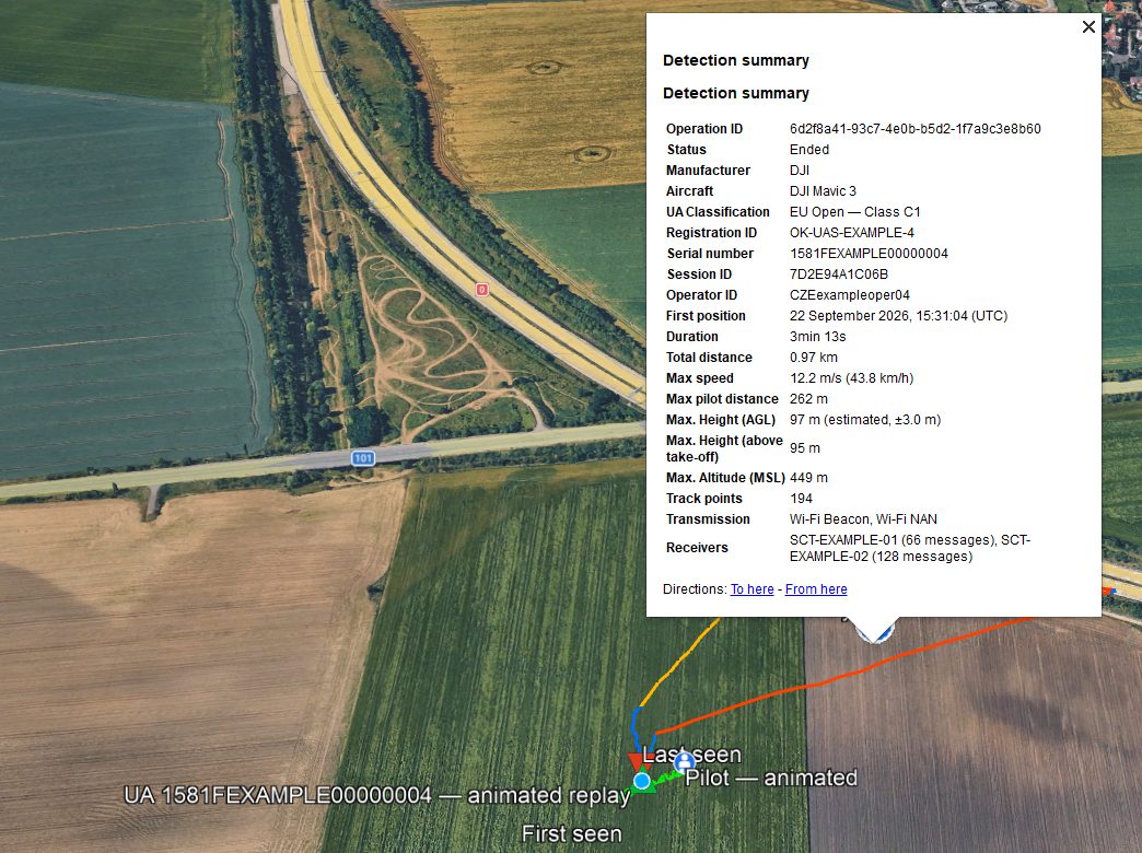
A few rows use different names from the CSV and JSON.
| In the KMZ | In CSV and JSON |
|---|---|
| Callsign | callsign (JSON: custom_callsign) |
| Description | The Self-ID text the drone sent. JSON only. |
| First position | time_first_telemetry |
| Max. Height (AGL) | max_alt_agl |
A record with no positions shows Start instead of First position.
Replaying a Flight
Use the time slider at the top of the map. Press play or drag it. If you don't see the slider, choose View → Show Time.
The Follow the aircraft tour flies the camera along the track. Find it in the Places panel and press play.
Units, Times and Credits
Distances, speeds and heights are in metric units, or imperial ones where the place you export from lets you choose. Times are in UTC, for example "15:31:04 (UTC)".
If the heights above ground came from terrain data that must be credited, the credit is in the description of each flight's folder, under Terrain data. See Terrain Data and Attribution.